


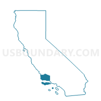
Voting District 40046, Santa Barbara County, California
About
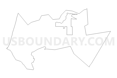
Outline

Summary
| Unique Area Identifier | 543151 |
| Name | Voting District 40046 |
| County | Santa Barbara County |
| State | California |
| Area (square miles) | 24.01 |
| Land Area (square miles) | 23.69 |
| Water Area (square miles) | 0.32 |
| % of Land Area | 98.68 |
| % of Water Area | 1.32 |
| Latitude of the Internal Point | 34.94596280 |
| Longtitude of the Internal Point | -120.59641330 |
Maps


Graphs
Select a template below for downloading or customizing gragh for Voting District 40046, Santa Barbara County, California


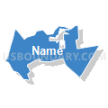

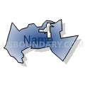
Neighbors
Neighoring Voting District (by Name) Neighboring Voting District on the Map
- Voting District 40005, San Luis Obispo County, CA
- Voting District 40010, San Luis Obispo County, CA
- Voting District 40047, Santa Barbara County, CA
- Voting District 40049, Santa Barbara County, CA
- Voting District 40056, Santa Barbara County, CA
- Voting District 40061, Santa Barbara County, CA
- Voting District 40062, Santa Barbara County, CA
- Voting District 40111, Santa Barbara County, CA
- Voting District 40621, Santa Barbara County, CA
- Voting District 40786, Santa Barbara County, CA
- Voting District 40793, Santa Barbara County, CA
- Voting District OCEAN, San Luis Obispo County, CA
- Voting District OCEAN, Santa Barbara County, CA
Top 10 Neighboring County Subdivision (by Population) Neighboring County Subdivision on the Map
- Arroyo Grande CCD, San Luis Obispo County, CA (76,029)
- Lompoc CCD, Santa Barbara County, CA (57,742)
- Guadalupe CCD, Santa Barbara County, CA (7,345)
Top 10 Neighboring Place (by Population) Neighboring Place on the Map
Top 10 Neighboring Elementary School District (by Population) Neighboring Elementary School District on the Map
- Santa Maria-Bonita Elementary School District, CA (98,324)
- Orcutt Union Elementary School District, CA (34,142)
- Guadalupe Union Elementary School District, CA (7,155)
Top 10 Neighboring Secondary School District (by Population) Neighboring Secondary School District on the Map
Top 10 Neighboring Unified School District (by Population) Neighboring Unified School District on the Map
Top 10 Neighboring State Legislative District Lower Chamber (by Population) Neighboring State Legislative District Lower Chamber on the Map
Top 10 Neighboring State Legislative District Upper Chamber (by Population) Neighboring State Legislative District Upper Chamber on the Map
Top 10 Neighboring 111th Congressional District (by Population) Neighboring 111th Congressional District on the Map
Top 10 Neighboring Census Tract (by Population) Neighboring Census Tract on the Map
- Census Tract 123.04, San Luis Obispo County, CA (8,954)
- Census Tract 25.02, Santa Barbara County, CA (7,345)
- Census Tract 26.06, Santa Barbara County, CA (3,344)